Advanced (3D-) techniques for data processing and -analysis
We would like to offer you a glimpse into our office!
TerraCarta positions itself as a leading entity in the detection of sinkholes and directional drilling, mapping cables and pipelines, and assessing the conditions within concrete structures. This is achieved through advanced equipment and sometimes just a shovel. All of this generates data that needs to be processed into drawings or a (3D-) model.
We employ sophisticated (3D-) techniques for data processing and analysis. In addition to our proficiency in using programs associated with our equipment, we also work with tools for data processing, allowing us to provide highly accurate (3D-) information.
While in the past, providing a hardcopy (PDF) sufficed, we now observe a shift towards delivering information for advanced BIM and/or GIS systems. Furthermore, there is a growing demand for advice regarding the impact of our findings. For instance, if cables are not where expected, a design may become unfeasible. In the rail sector, we are already working on the “feasible design” product, combining our data acquisition and design skills.
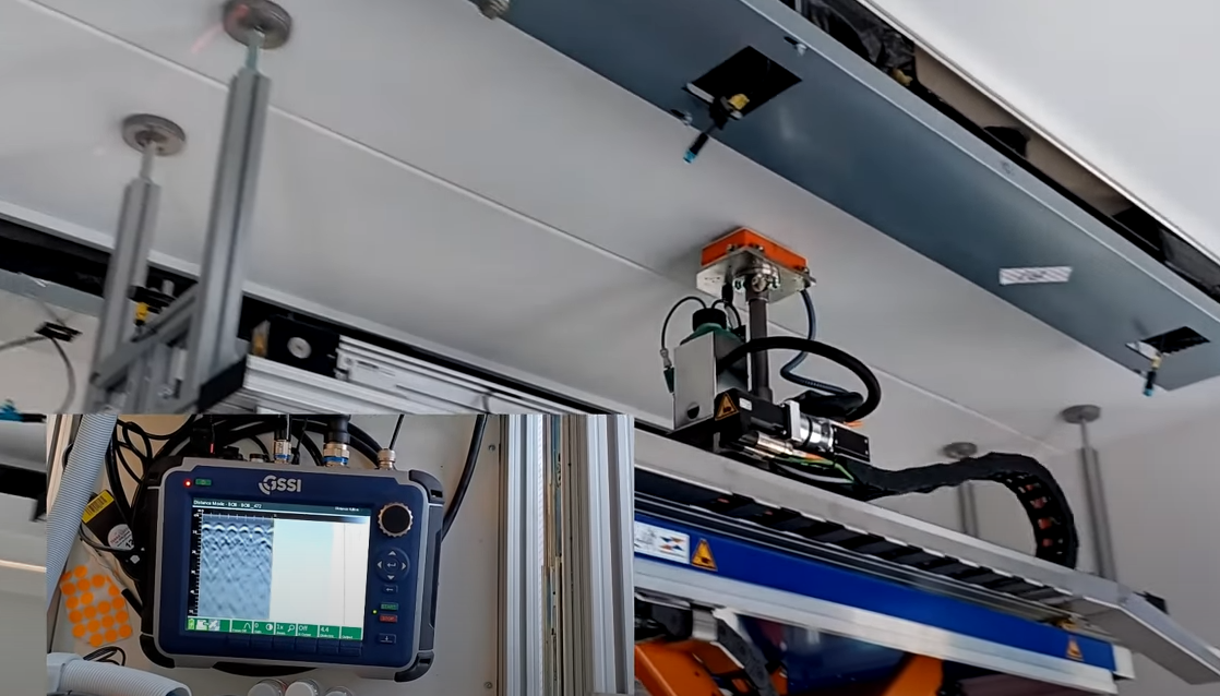
We also employ data analysis and processing in the construction sector. For instance, we fully scanned a bridge, both externally and internally within the concrete. Subsequently, a 3D-wireframe model of the reinforcement was created. Planned concrete drillings were overlaid onto this model, and a ‘clash detection’ was performed. This allows us to predict, down to the centimeter, where drillings will intersect the reinforcement, enabling us to adjust the planned drilling points. The new drilling points can then be marked on the bridge using a laser, ensuring that no reinforcement is hit.
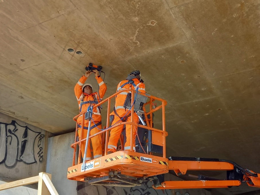
Another concept we have developed is the direct link between fieldwork and the engineers at the office. The Ministry of Economic Affairs building is scanned by us for the positioning of reinforcement, cables, pipelines, and other structural elements. Boreholes are then placed to reinforce the structure. What makes this unique is that as soon as our concrete robot completes the scan, we can interpret the data online in the office. Subsequently, we determine the correct positions for the boreholes, which are then sprayed onto the ceiling by the same robot.
Another promising development we would like to share with you is our new app, the ‘TerraViewer.’ This app will assist many in preventing excavation damage. The TerraViewer is designed for industrial sites. In this app, the location of each cable or pipeline is immediately visible. It also allows easy on-site navigation to the exact location of cables and pipelines.
This not only prevents excavation damage but also makes tasks like maintenance and management of your pipelines much more straightforward.
More about the TerraViewer coming soon!